
Florida Flood Watch: Up to 12 Inches of Rain Forecast for Orlando, Disney World and the Space Coast Through Friday

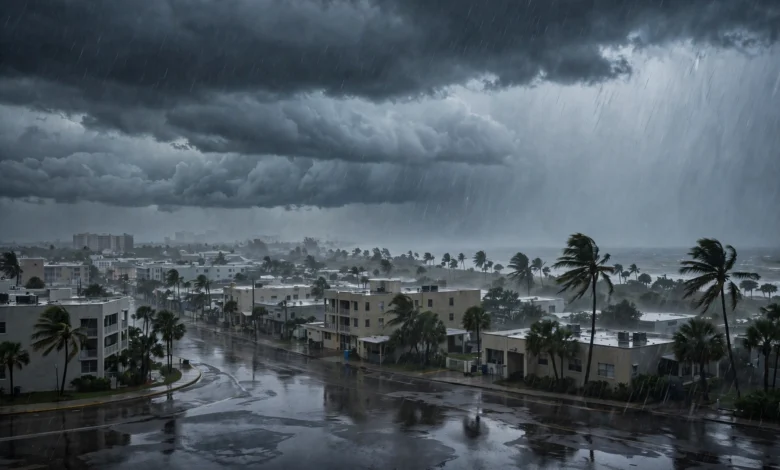
The National Weather Service in Melbourne issued a flood watch on Monday afternoon for nine counties across east-central Florida, and the watch takes effect at 5 p.m. EST on Tuesday, November 17. Forecasters expect 3 to 6 inches of rain across most of the watch area through Friday evening, with isolated coastal spots possibly receiving 8 to 12 inches.
The watch runs until 7 p.m. EST on Friday, November 20, and it covers every east-central Florida county except Lake County. A separate flood watch from the National Weather Service in Miami covers Palm Beach County from Tuesday afternoon until 7 p.m. on Thursday, November 19.
Nine counties, from Daytona Beach to Stuart
The Melbourne office’s watch covers Volusia, Seminole, Orange, Osceola, Okeechobee, Brevard, Indian River, St. Lucie and Martin counties. Major communities inside the area include Orlando, Kissimmee, Sanford, Daytona Beach, Titusville, Cocoa Beach, Melbourne, Palm Bay, Vero Beach, Fort Pierce, Port St. Lucie and Stuart.
| County | Main communities | Watch window |
|---|---|---|
| Volusia | Daytona Beach | Tue 5 p.m. – Fri 7 p.m. EST |
| Seminole | Sanford | Tue 5 p.m. – Fri 7 p.m. EST |
| Orange | Orlando | Tue 5 p.m. – Fri 7 p.m. EST |
| Osceola | Kissimmee | Tue 5 p.m. – Fri 7 p.m. EST |
| Okeechobee | Okeechobee | Tue 5 p.m. – Fri 7 p.m. EST |
| Brevard | Melbourne, Titusville, Cocoa Beach | Tue 5 p.m. – Fri 7 p.m. EST |
| Indian River | Vero Beach | Tue 5 p.m. – Fri 7 p.m. EST |
| St. Lucie | Port St. Lucie, Fort Pierce | Tue 5 p.m. – Fri 7 p.m. EST |
| Martin | Stuart | Tue 5 p.m. – Fri 7 p.m. EST |
| Palm Beach (NWS Miami) | West Palm Beach, Boca Raton | Tue 5 p.m. – Thu 7 p.m. EST |
Walt Disney World sits in Orange and Osceola counties, so the entire resort falls inside the watch area. The National Weather Service in Melbourne posted the watch on Monday afternoon, warning that most likely rainfall amounts of 3 to 6 inches are forecast through Friday, with isolated higher amounts of 8 to 12 inches or more along the coast.
Rain arrives in rounds, not one burst
The rain will not arrive in a single downpour. Forecasters expect repeated rounds of showers and heavy downpours, day after day, over ground that is already wet from recent rain. That pattern is what raises the flood risk, even though no single storm is forecast to be severe on its own.
The Weather Prediction Center rates the excessive-rainfall risk at Level 1 to 2 out of 4, marginal to slight, for each day from Tuesday through Friday. Parts of Florida’s Atlantic coast are under a Slight Risk of excessive rainfall for Tuesday, November 17. The highest flood risk is expected between Wednesday, November 18, and Thursday, November 19, particularly along the coast south of Cape Canaveral.
Flooding is already a problem in one part of the region. Exceptional rainfall across the St. Johns River basin, especially near its headwaters, has led to river flooding that the Melbourne office says is likely to persist for several weeks.
Beaches, boats and the Space Coast
The same weather system is roughing up the coast. The National Weather Service reports a high risk of rip currents at area beaches on Tuesday and says entering the water is strongly discouraged. A high surf advisory runs from Tuesday evening until Thursday afternoon, and a small craft advisory is in effect until Thursday afternoon.
Brevard County, home to Cape Canaveral launches, is also under the watch, and the same coastline that hosts Florida’s launch pads will take some of the heaviest rain. The watch area’s coastal counties are where forecasters expect the highest totals, with isolated spots possibly topping a foot of rain where the heaviest bands stall.
What a flood watch means for residents
A flood watch is a heads-up, not a guarantee. It means conditions are favorable for flooding to develop, and forecasters will upgrade it to a flood warning if flooding becomes likely or starts happening. Residents should keep an eye on updated watches and warnings through the National Weather Service in Melbourne and avoid driving through flooded roads, where the water’s depth is often impossible to judge.
The Weather Service’s flood safety guidance is clear on one point above all: never drive around barricades or through flooded streets, and move to higher ground if water starts rising near a home or vehicle. Most flood deaths in the United States happen in vehicles, and it takes only a small amount of moving water to sweep a car away.
Clouds will hide tonight’s Leonids in Florida
The timing is poor for skywatchers. The Leonid meteor shower peaks tonight, November 17–18, but thick cloud and rain across central Florida will block the view for most of the state. Clearer skies are forecast farther west, away from the Atlantic moisture feeding this week’s rain.
Residents in the watch area should prepare for a wet week rather than a single wet day. The watch stays in place until Friday evening, and forecasters say rainfall totals will keep climbing with each passing round of showers.
Frequently asked questions
Which Florida counties are under the flood watch?
Nine east-central counties are under the Melbourne office’s watch: Volusia, Seminole, Orange, Osceola, Okeechobee, Brevard, Indian River, St. Lucie and Martin. Palm Beach County is under a separate watch from the Miami office until Thursday evening.
How much rain is forecast in Florida this week?
Most areas should expect 3 to 6 inches of rain between Tuesday and Friday. Isolated spots along the Atlantic coast could receive 8 to 12 inches or more, with the highest risk on Wednesday and Thursday south of Cape Canaveral.
Is Walt Disney World under the flood watch?
Yes. Walt Disney World sits in Orange and Osceola counties, both of which are inside the watch area, which runs from Tuesday afternoon until 7 p.m. Friday.
When does the Florida flood watch end?
The Melbourne office’s watch ends at 7 p.m. EST on Friday, November 20. The separate Palm Beach County watch ends at 7 p.m. EST on Thursday, November 19.
What is the difference between a flood watch and a flood warning?
A flood watch means conditions are favorable for flooding to develop. A flood warning means flooding is happening or is expected very soon, and people in the warned area should act at once.